STATEWIDE AGRICULTURAL BASELINE PROJECT 2020 UPDATE
This report, along with the associated maps and geospatial data layers for all Hawai`i counties, provides a partial update to the more exhaustive 2015 statewide agricultural land use baseline (Melrose et al. 2015).
Statewide, outside of the major decline in sugarcane acreage on Maui, there was an overall 7% increase in planted acres for all other crop types from 2015 to 2020 (+7,588 acres). Of these statewide gains, the largest was in diversified agriculture, which rose 22% (+3,695 acres), with approximately half of that increase coming from Maui alone, which more than doubled its planted acreage in diversified crops.
VIEW THE FULL REPORT HERE:
2020 Update to the Hawaiʻi Statewide Agricultural Land Use Baseline
REPORT MAP HIGHLIGHTS:
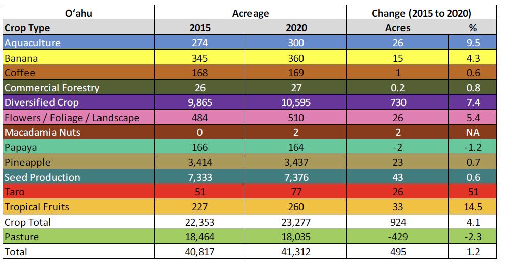
Summary of Oʻahu agricultural footprint and changes between 2015 (Melrose et al. 2015) and 2020.
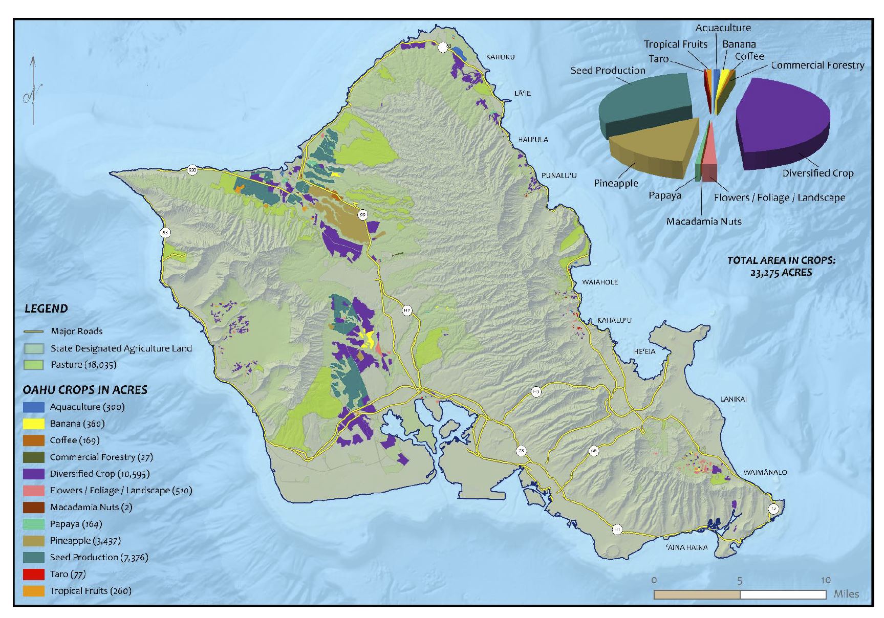
Oʻahu Agricultural Footprint in 2020.
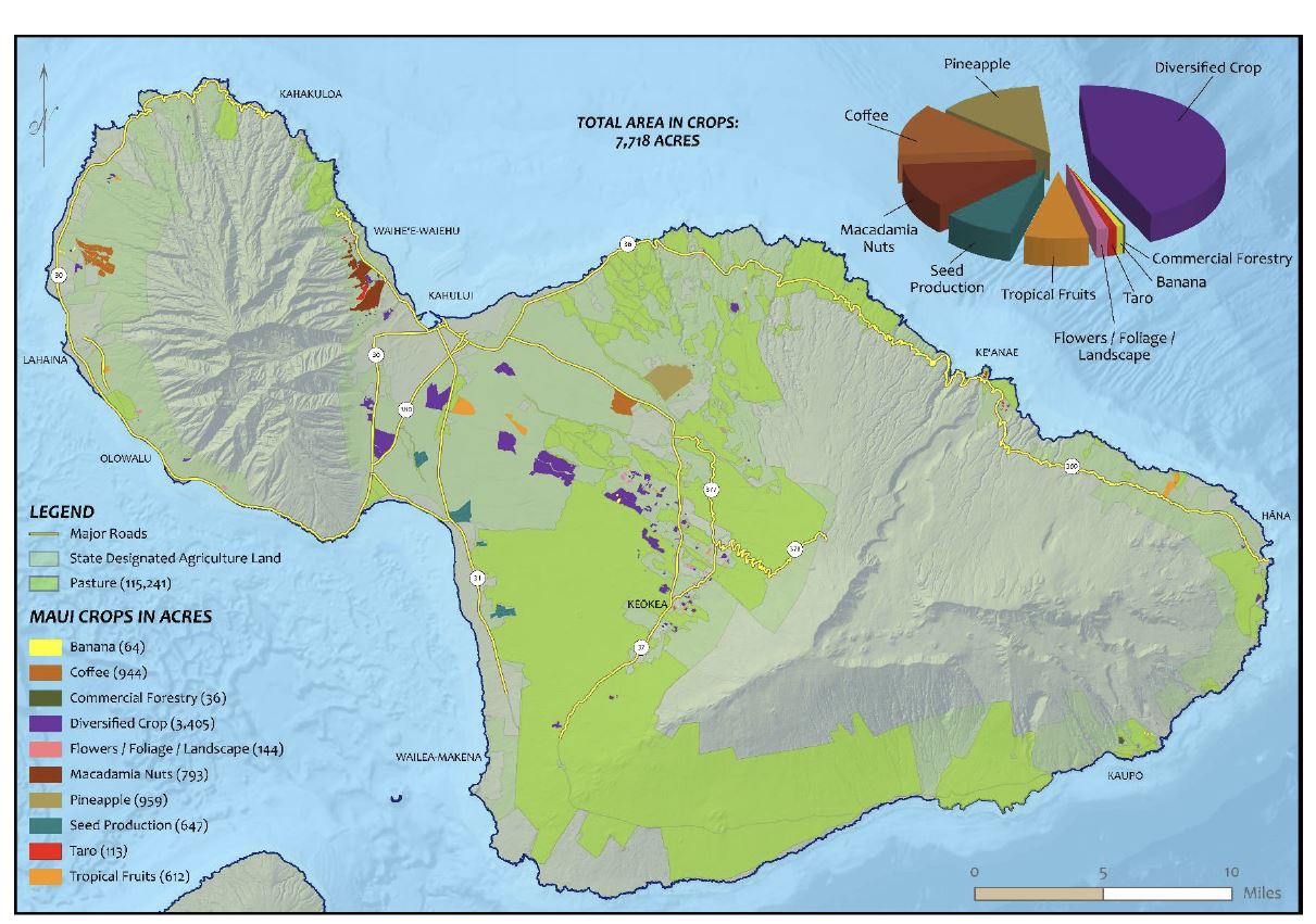
Maui Agricultural Footprint in 2020.
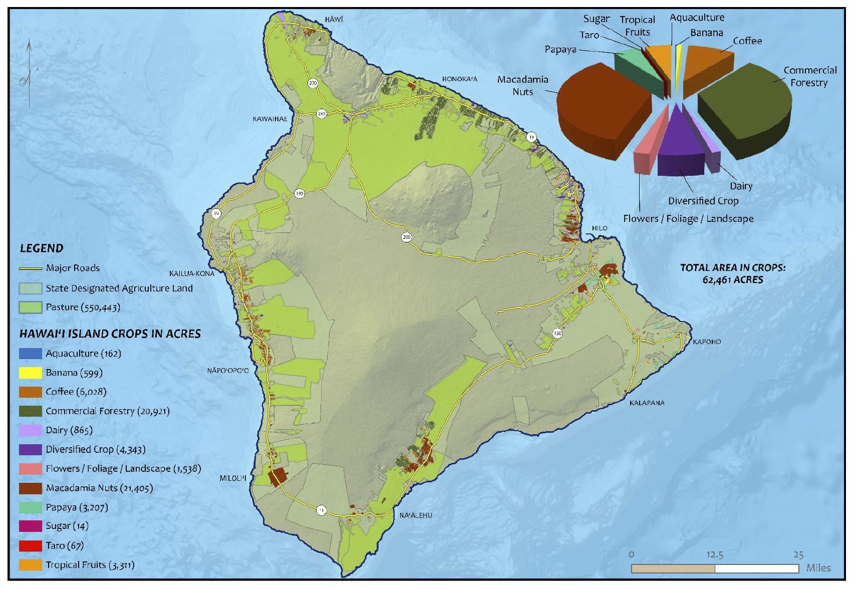
Hawai’i Island Agricultural Footprint in 2020.
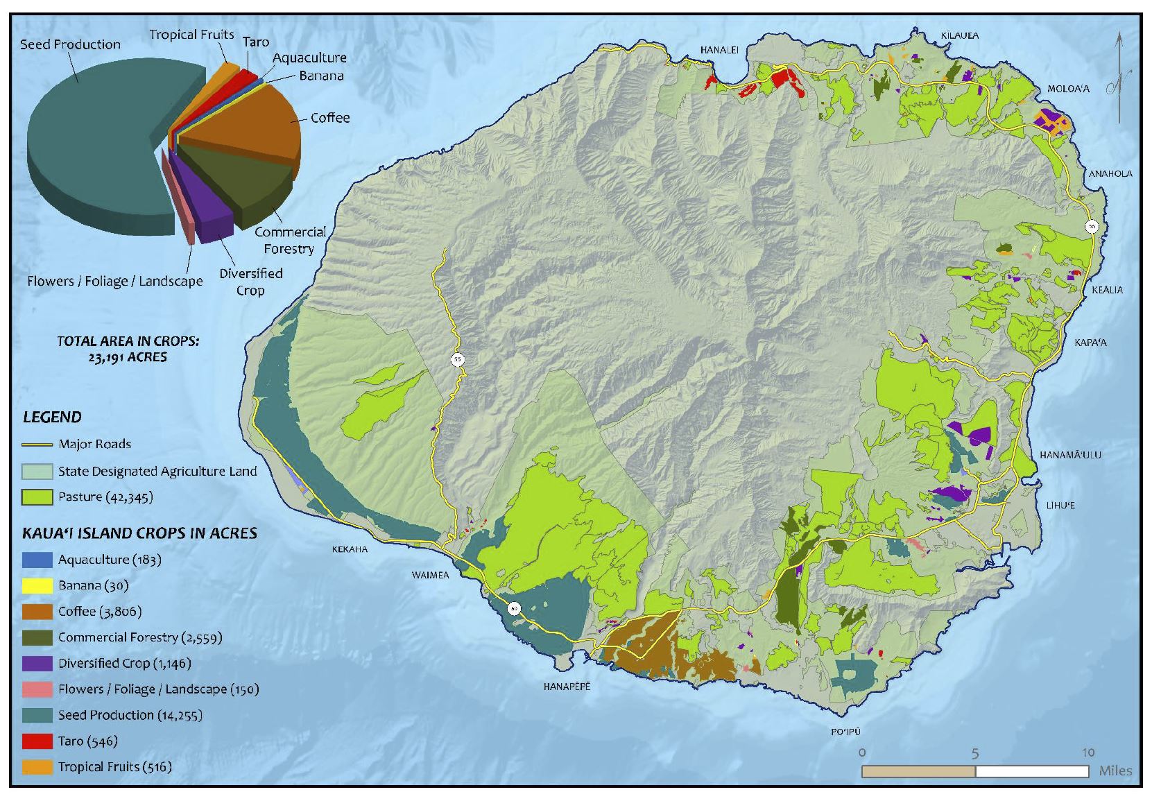
Kaua’i Agricultural Footprint in 2020.